River corridor multi-use trail
Illustrative highlight of the north-south multi-use corridor beside the North Saskatchewan River.
Illustrative overlay - not for navigation.

This workspace does not send information to the Town of Rocky Mountain House.
Official August 2025 map with an illustrative guide
Use the filters and text list to understand features shown on the Town map. This is an accessible demonstration, not a routing tool.
Illustrative overlay - not for navigation
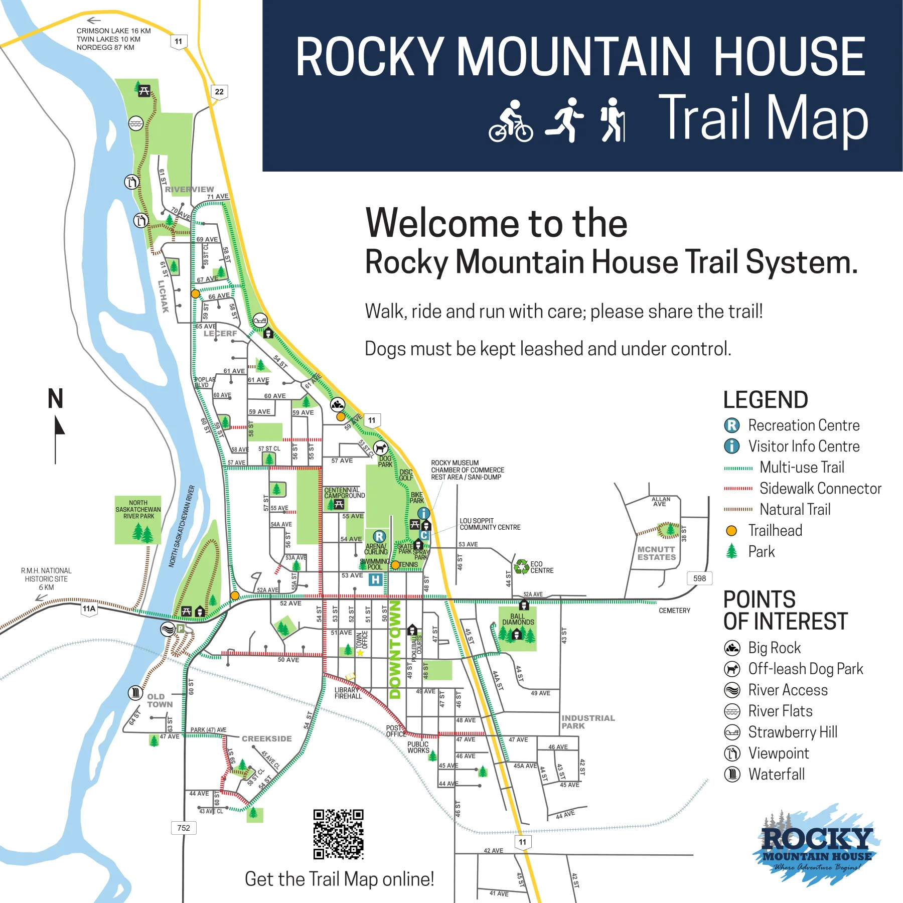
Every illustrative map highlight is also listed here. Selecting one moves focus to its description.
Illustrative highlight of the north-south multi-use corridor beside the North Saskatchewan River.
Illustrative overlay - not for navigation.
Illustrative highlight of sidewalk links that connect downtown streets to the broader trail system.
Illustrative overlay - not for navigation.
Illustrative highlight of the natural-surface segment toward the northern river park area.
Illustrative overlay - not for navigation.
Illustrative markers for trailheads shown on the official map. Confirm access on the official PDF.
Illustrative overlay - not for navigation.
Illustrative areas for the river park, downtown green spaces, and sports fields shown on the map.
Illustrative overlay - not for navigation.
Point of interest labelled Big Rock on the official map.
Illustrative overlay - not for navigation.
Point of interest for the off-leash dog park shown northeast of the town centre.
Illustrative overlay - not for navigation.
Two river-oriented points of interest identified on the official map.
Illustrative overlay - not for navigation.
Three labelled points of interest on the northern and western river corridor.
Illustrative overlay - not for navigation.
JavaScript is unavailable. All map features and descriptions remain above, and this form can show one selection with a full page reload.
Checked: 23 August 2026
Demonstration limitation: This local proposal experience is not a live Town service and does not prove Town delivery or acceptance.
External links open the official Town source. Confirm current information there before acting.